
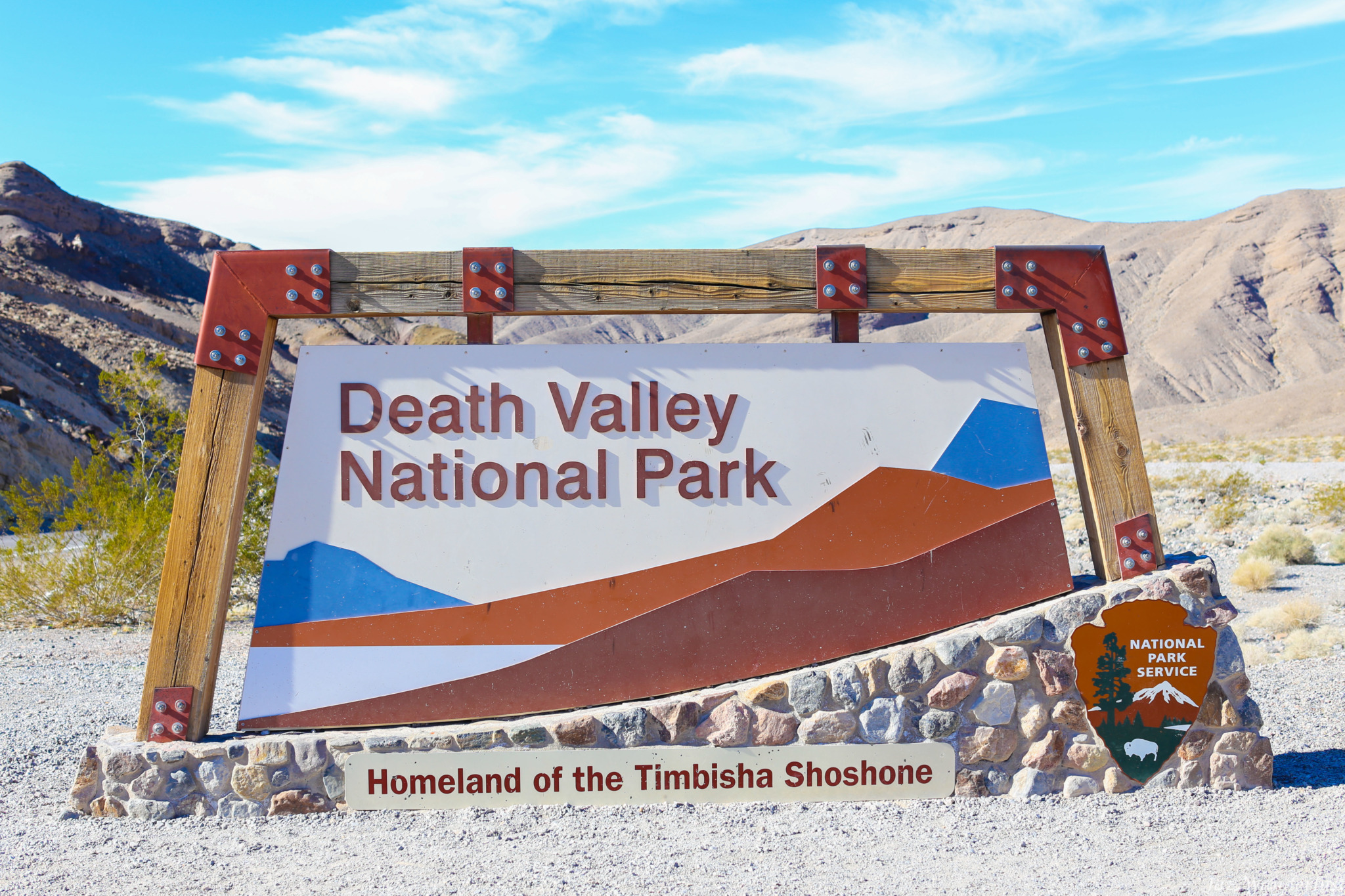
Death Valley National Park is the largest national park in the contiguous United States with over 3 million acres of wilderness. It is considered the driest and hottest of all the national parks in the United States. In 1913, Death Valley’s temperature was recorded at 134 °F (56.7 °C). It was considered as the highest temperature ever recorded at the surface of the Earth. There is a lot to do in Death Valley such as sand boarding on the dunes, hiking in slot canyons, strolling along salt flats, climbing rocky peaks, and walking to the bottom of the volcano crater. This is my 4 days in Death Valley itinerary so you can also plan a trip to see this amazing national park!
We visited Death Valley recently during the winter break with our friends and their kids ranging from 8 to 11 years old. Winter is a great time to visit the park since it is considered as off-season and the weather is colder. It is beautiful to explore the valley with the snow capping the high peaks. If you can, try to stay away from visiting Death Valley in summer as the weather can be extremely hot.
Cell phone service within the park is limited. We didn’t have any Verizon cell phone service in the park except at Furnace Creek. Prior to the trip, we downloaded Google offline map for Death Valley to get around the park.
Death Valley Itinerary
Day 1
We arrived at the entrance (I-15 N -> CA-127 N -> CA-190 W) of Death Valley around 1:30 P.M. Death Valley is about 4 hours from Orange County. Entering the park was free for us since our kid has a 4th Grade Pass. The goal is to provide an opportunity for every 4th grade student across the country to experience their federal public lands and waters in person. All 4th graders receive free access to national parks for an entire year. There are different locations to pay the entrance fee including the fees machines, which accept credit cards.
Dante’s View
Our first stop was supposed to be at Dante’s View, but it was closed due to construction so we could not go there. Dante’s View is a popular spot that offers breathtaking view over 5,000 ft above the valley floor. At this high altitude, you can see across most of the 110-mile long Death Valley. The best time to visit it is in the morning where the view is stunning.
Twenty Mule Team Canyon
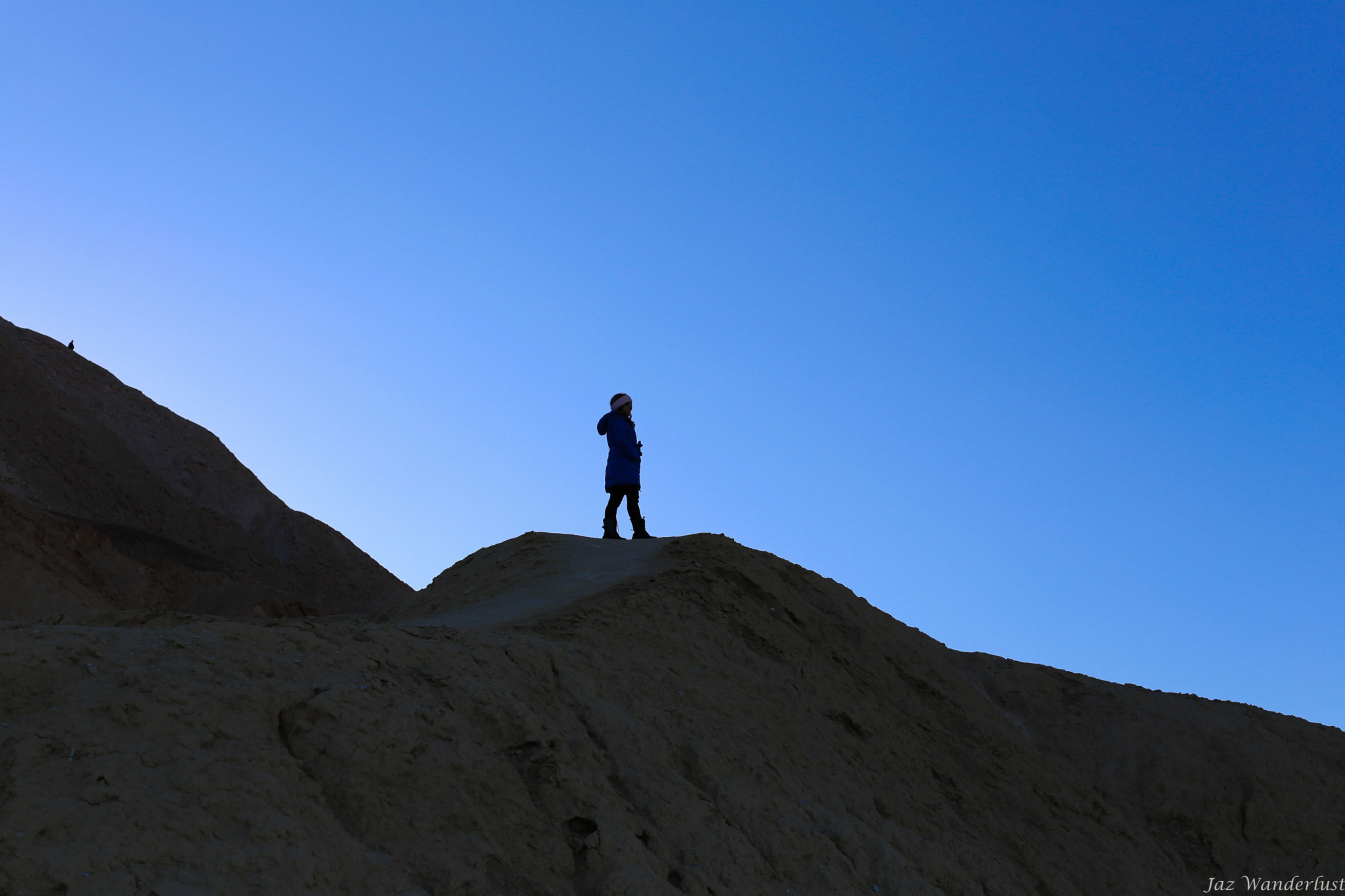
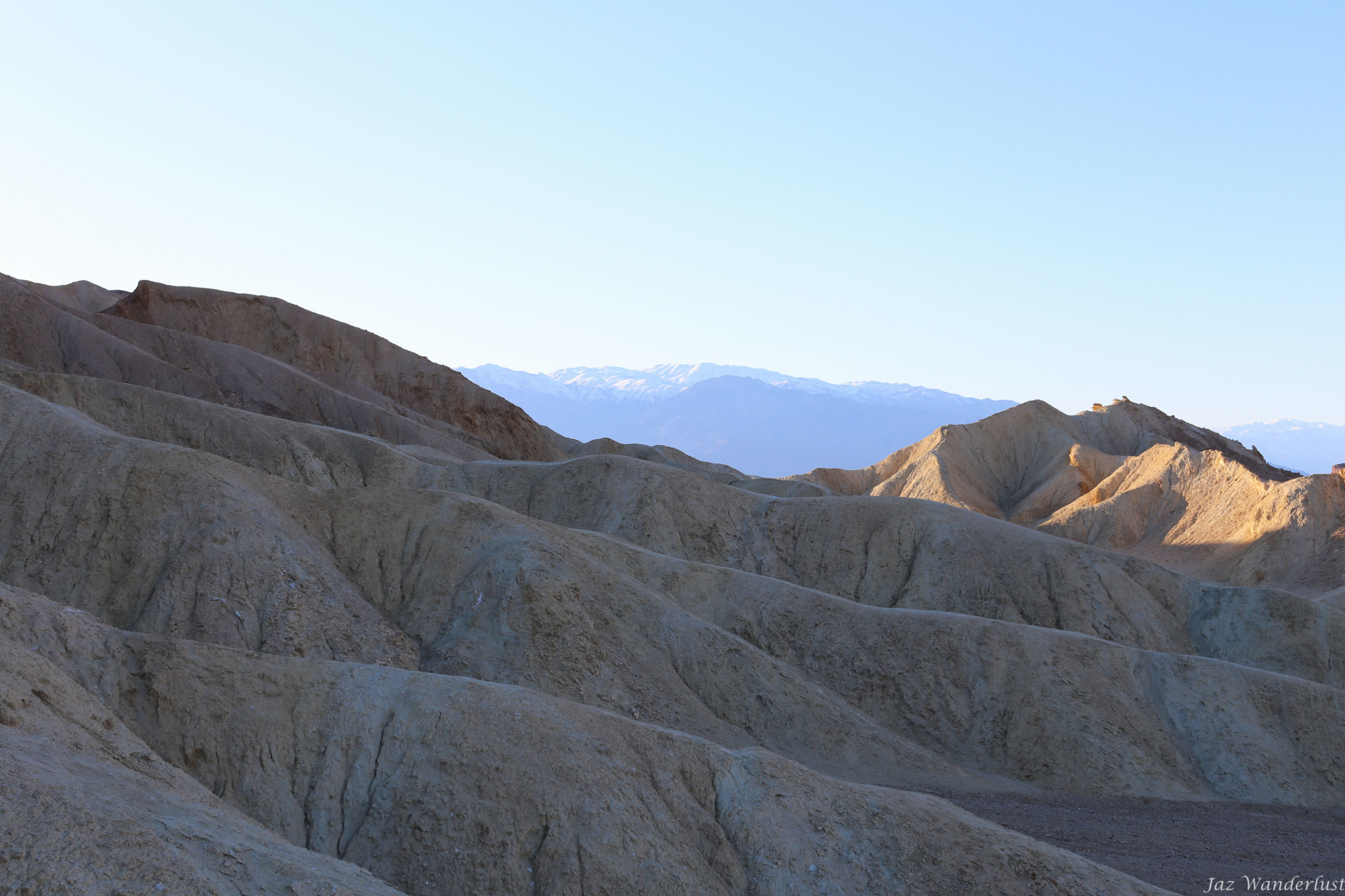
We then stopped by Twenty Mule Team Canyon, which offers colorful badlands (area where soft rock strata are eroded into various strange shapes) of the Black Mountains. We had fun climbing and enjoying the spectacular landscape.
Zabriskie Point
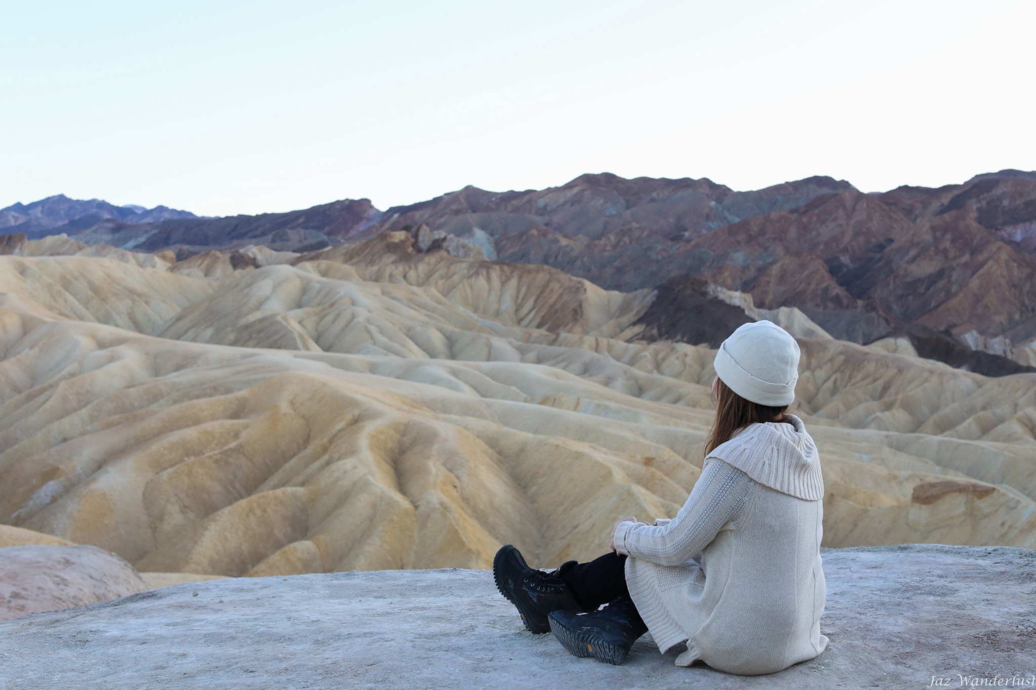
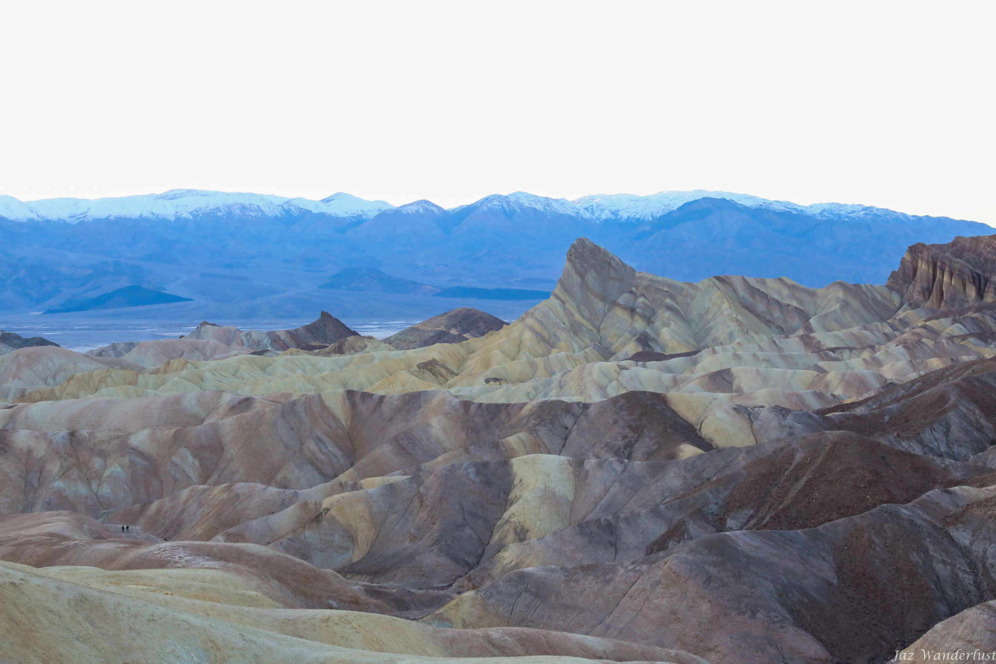
Our last stop was at Zabriskie Point where we saw golden-colored badlands with the Black Mountains as a backdrop. From the parking area, walk about 1/4 mi (400 m) on the paved path to the viewpoint. Zabriskie Point is best viewed during the sunrise as the colored badlands are especially stunning.
Day 2
Devil’s Golf Course
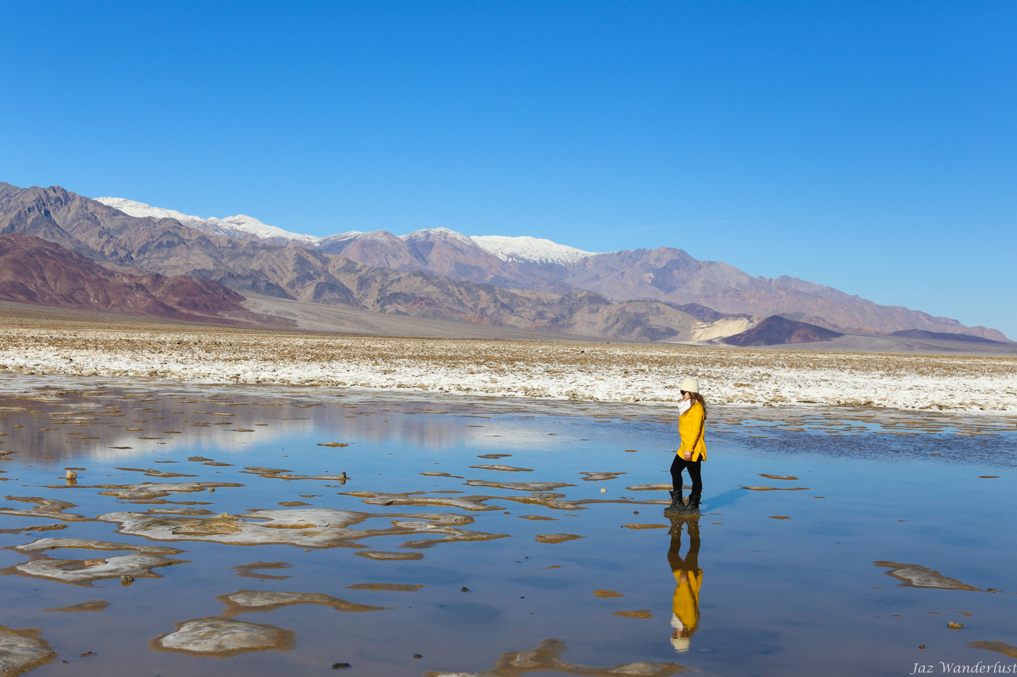
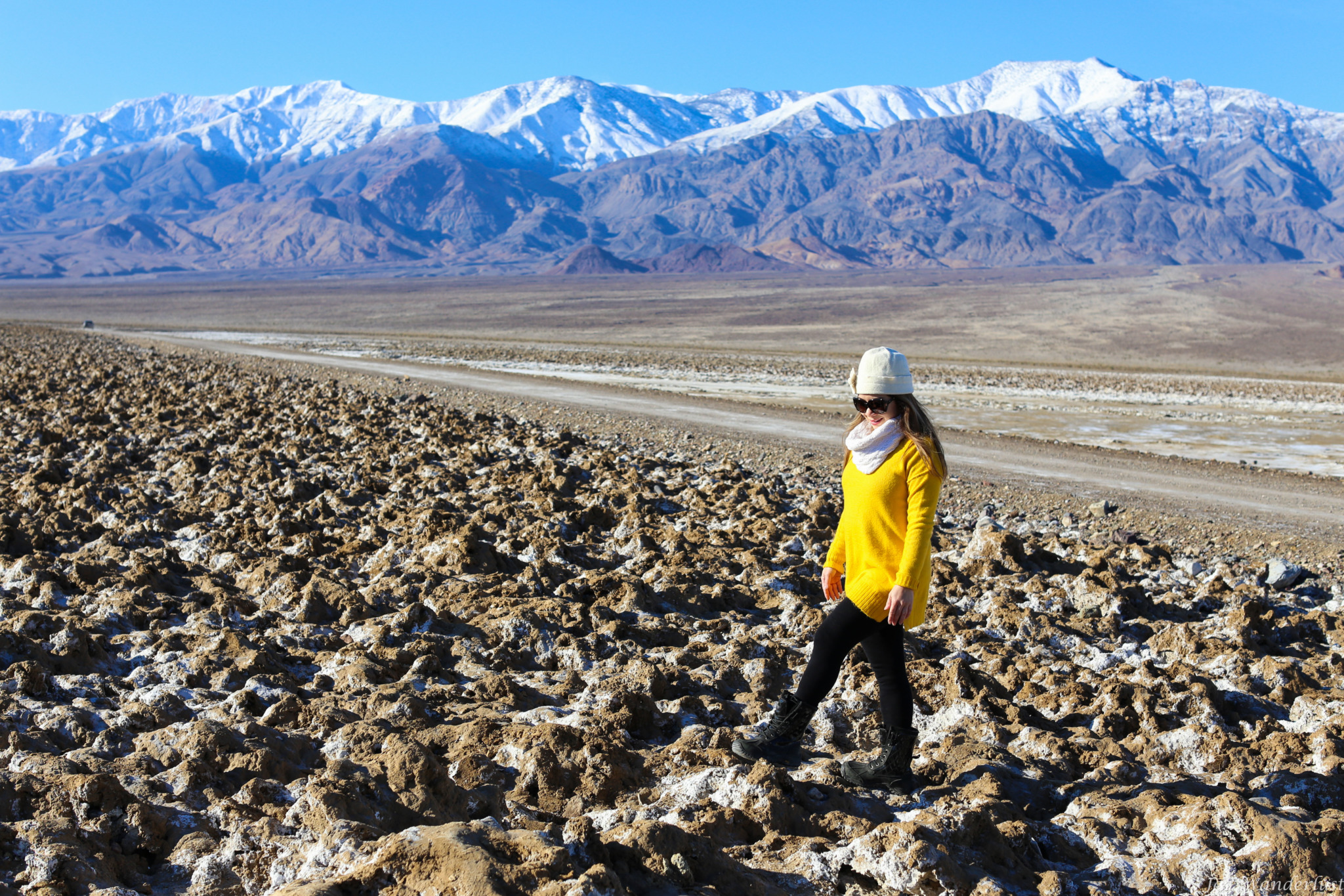
This morning, we made our first stop at Devil’s Golf Course, which is a large salt pan on the floor of Death Valley. The gnarled crystalline salt spires dot the landscape and look like a coral reef run wild. A few thousand years ago, the salt lake dried up and left behind dissolved minerals, which are what we see today. While driving to Devil’s Golf Course, we made a turn too early and turned right onto West Side Rd from Badwater Rd instead of Salt Flat Rd. However, it turned out to be a perfect area for pictures. After spending some time here, we headed to Salt Flat Rd to visit Devil’s Golf Course. The salt pieces are actually bigger here, but we thought the view was not as nice as the one on West Side Rd.

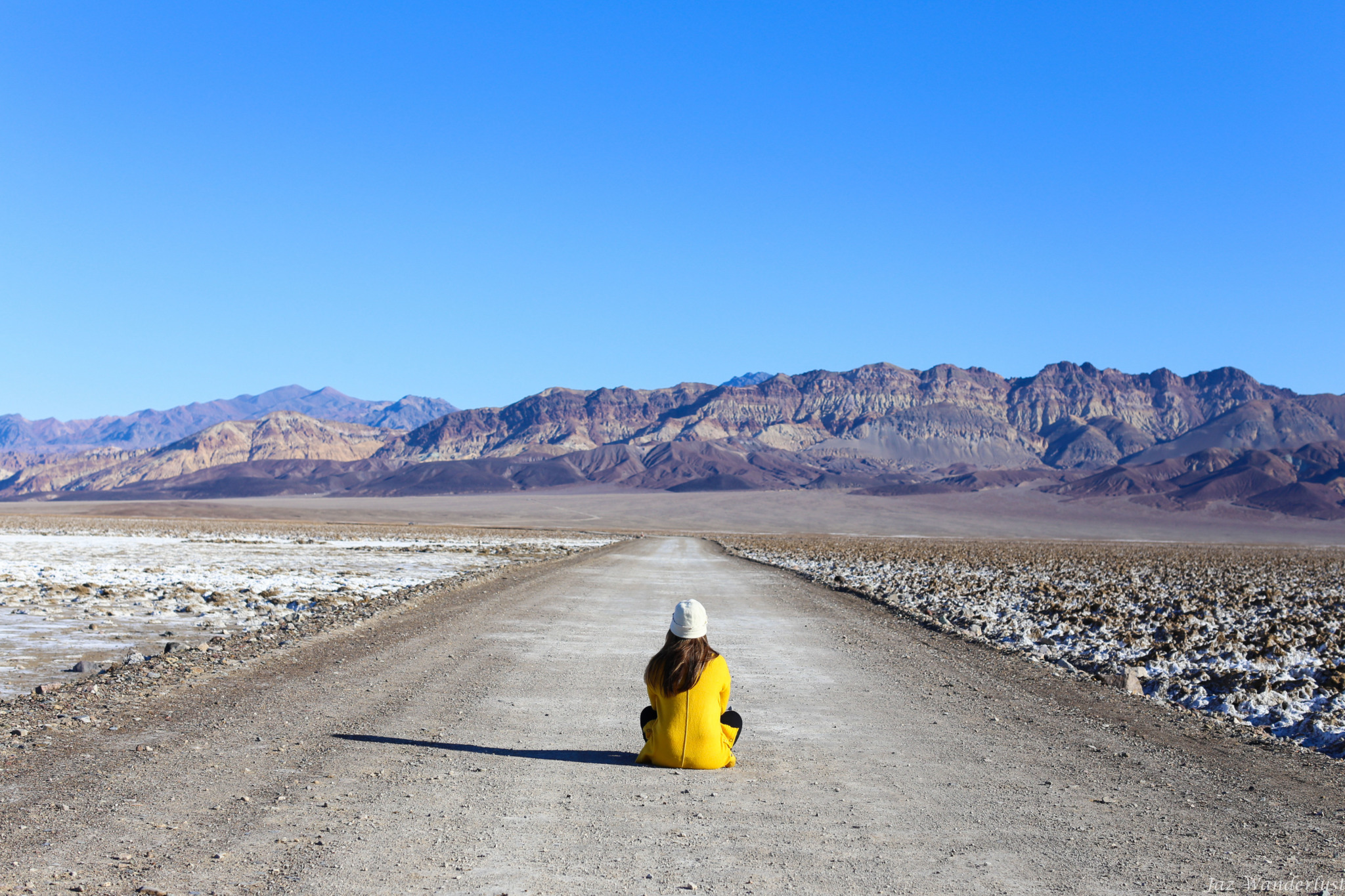
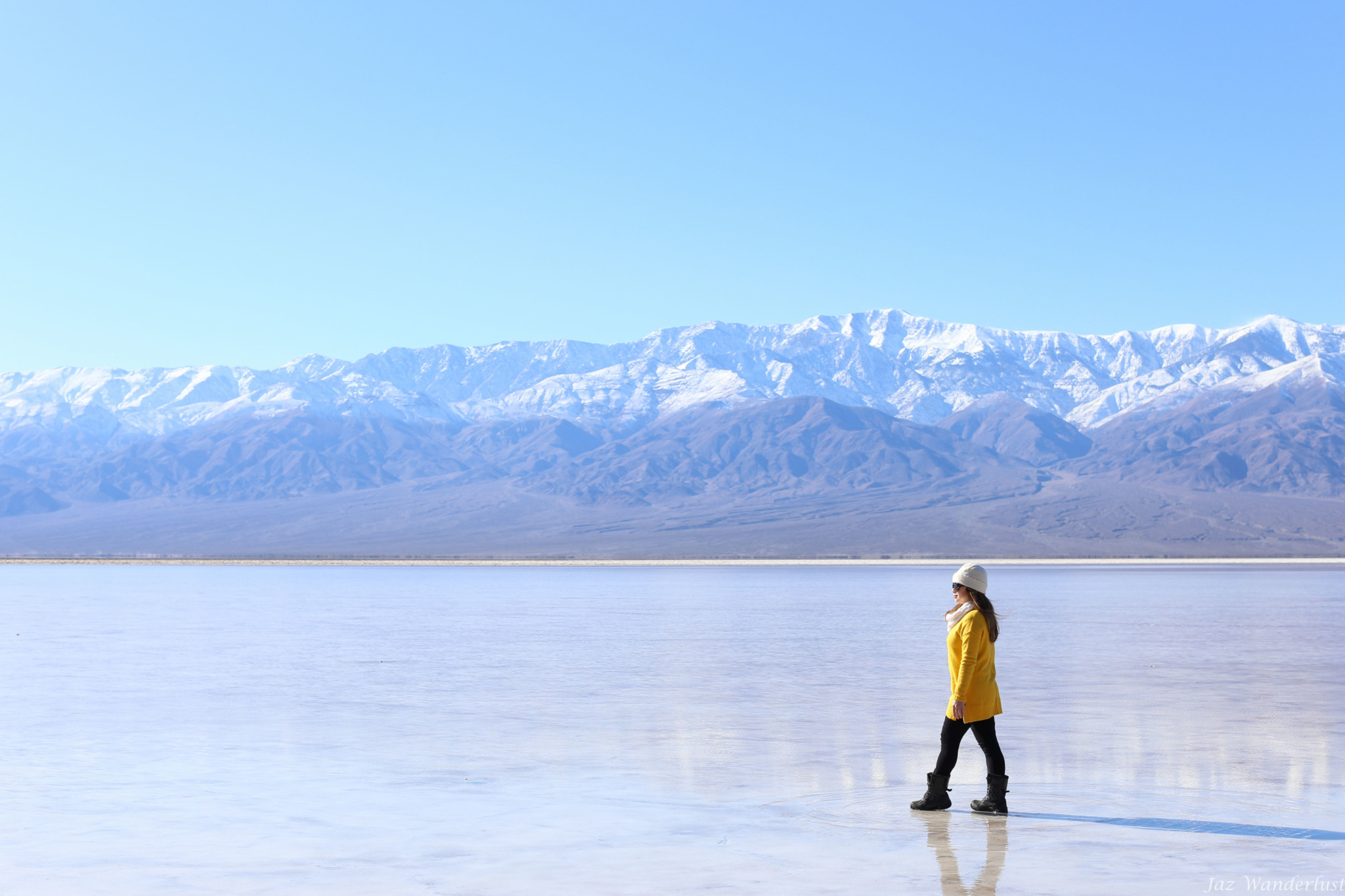
Badwater Basin
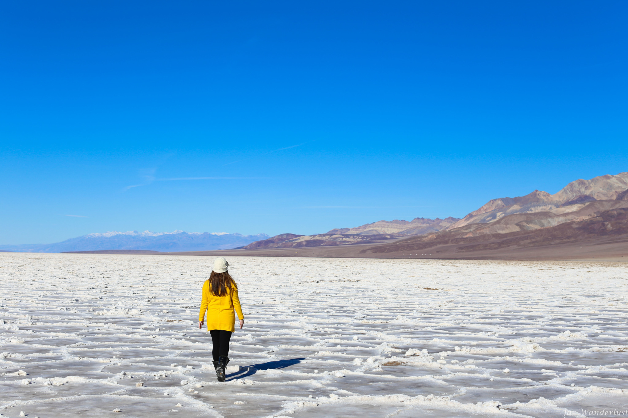
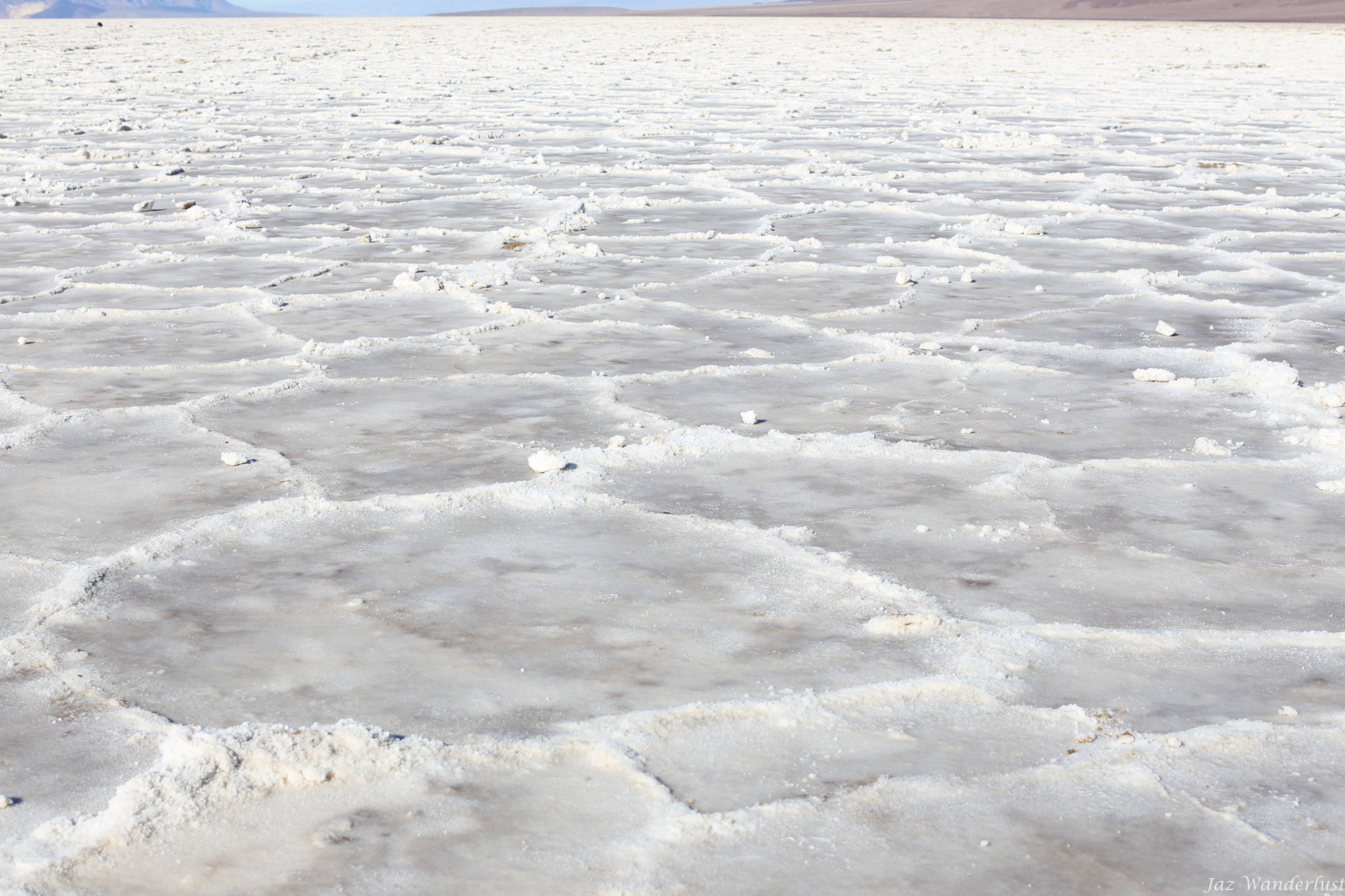
We were excited for our next stop at Badwater Basin as it is the lowest point in North America, at 282 ft (86 m) below sea level. From the parking area, we walked about 1/2 mile to edge of salt flat to see the stunning of the salt crystal polygons. The salt crystals expand, pushing the crust of salt into rough, chaotic forms. The majority of salts on Badwater Basin are table salt (sodium chloride). Two to four thousand years ago, the basin was the site of a 30-foot-deep lake that evaporated and left a one to five foot layer of salt in its wake. Other evaporate minerals here include calcite, gypsum and borax.
Natural Bridge
The Natural Bridge is about 35 feet thick and the same height above the canyon floor. While carving the canyon, the stream sought course along the path of least resistance, and so formed a sharp bend that eventually eroded into a fin of rock. From the parking lot, it’s a short walk of about 1/3 of a mile to reach the Natural Bridge. We have seen a few natural bridges in the past and we were not impressed with this one. If you have never seen a Natural Bridge before, then you should definitely see it. Otherwise, you can skip it.

Artists Drive
After visiting the Natural Bridge, we did a scenic loop drive through multi-hued hills. It is a 9 mile (14.5 km) dipping, curving, one-way drive that takes you through canyons with many areas covered in colorful rock formations. The highlight of the drive is Artist’s Palette where sea green, lemon, yellow, periwinkle blut and salmon ink mineral deposits are splashed across the barren background. This stop has variety of colors and rock formations, which are unique to Death Valley. This is a must for anyone’s Death Valley itinerary.

Golden Canyon
We hiked 2.7 miles round trip to see the colorful canyons carved through golden badlands. The Golden Canyon is a must-do-hike while in Death Valley. We got to Golden Canyon around 3:30 P.M. and hiked to the Red Cathedral. This site is where different Star Wars movies were filmed (Star Wars Episode IV — A New Hope and Star Wars Episode VI — Return of the Jedi.) If you are interested in Star Wars, check out this site for film locations.
By the time we were heading back, it got dark early and quickly since it was winter. We were prepared with flashlight in case if we got stuck out after dark and it helped us get to our car safely. As we were leaving, we saw some people who tried to hike to the Red Cathedral in the dark. I do not recommend hiking in the dark as you cannot enjoy the beauty of the Red Cathedral plus some areas were narrow and can be dangerous if you tripped.

Day 3
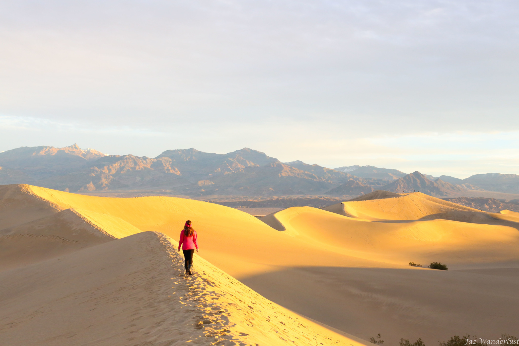
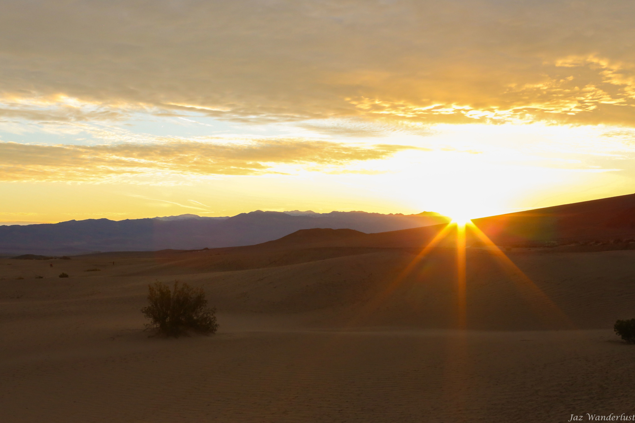
Mesquite Flat Sand Dunes
We got to the Mesquite Flat Sand Dunes before sunrise this morning to enjoy the magnificent view and avoid the crowds’ footprints during the day. Some of the dunes rise nearly 100 ft (30 m) from the desert floor. We hiked for a couple miles to the top of the dune where we had our own dune. There is no formal trail to follow and you can walk as long as you want and make your own path. The further you walk out, the less people and footprints around you. We had a sand board and it was fun sliding down the dunes. The kids really enjoyed sand sledding on the sand dunes.


Ubehebe Crater
Hundreds of years ago, a massive volcanic explosion caused by magma mixing with an underground spring eft a 600 ft (183 m) deep crater. We hiked around the rim of Ubehebe Crater and thought the initial climb was moderately difficult. People were walking to the bottom of the main crater, which was easy to get to. However, the trip back up can be exhausting so we decided to skip this hike.

The Racetrack
The Racetrack is known of it’s mysterious sliding rocks, which are caused by erosion forces to tumble to the surface of the Racetrack. The road to Racetrack is rough, narrow, rocky and requires 4×4 wheels. The road sign stated “High Clearance 4×4 Recommended”, but we think it should be required. We drove about 1/3 of the way to it, but had to turn around due to the snow started to show up everywhere and we did not have any snow chains. We decided to pull over to play in the snow before we headed back out. Many places on this road are only wide enough for one vehicle. You need to be prepared to drive up onto the gravel and wait for oncoming cars to pass you. The sharp rocks can hit the gas tank and cause the gas to leak. We did witness it happened to one Jeep while we were there. If you do decide to visit The Racetrack, then you can rent a 4×4 Jeep at Farabee’s Jeep Rental in Furnace Creek.

Day 4
Borax Museum
This morning, we checked out of our room and stopped by the Borax Outdoor Museum, which is located at our hotel, The Ranch at Death Valley. The kids enjoyed learning about Death Valley’s mining and railroad history. After spending about an hour at the Borax Museum, we headed home. Overall, we all had a great time exploring Death Valley National Park as there are so much to do here.


Our Lodge
We spent 3 nights at The Ranch of Death Valley. There are 224 hotel rooms, a saloon, a general store, a coffee bar, restaurants, tennis, basketball, and volleyball courts, a playground for kids, and a pool. It is very convenient to have everything in one spot. The deluxe room was comfortable as it’s located in a single-story building with a small patio adjacent to the parking area. The kids had fun playing in the playground. The only downside was the poor housekeeping service that we received. Our housekeeper forgot to refill the hand soap, conditioner, and tissue for us. In addition, the housekeeper did not seem to understand our request and kept on bringing the items to the room.
Tips Before You Go:
- Take plenty of water and snacks.
- Fuel up before arriving to the park.
- Beware of potential flash floods and check weather forecasts before hiking.
- Stop by Furnace Creek Visitor Center to pick up a free Junior Ranger booklet for kids.
- Download Google offline map to access the park.
- Rent a 4×4 Jeep in Furnace Creek if you plan to visit Racetrack Playa.
If you have been to Death Valley before, what other places should I add to my next Death Valley itinerary that you enjoyed?
For more ideas what to see in Death Valley National Park see this article from my friend Asya Olson.
For more California travel inspiration, check out my Southern California travel page!